
Finding a fishing spot can be one of the most challenging aspects of angling, particularly for budding anglers. Figuring out where to start is a time-consuming process for even the most experienced anglers. Scouring forums, expert opinion, Google Maps and catch reports to find the best-looking marks is a time-consuming process, but an essential one if you want to become a self-sufficient fisherman.
Here we’ve broken down everything you need to know to find your own fishing marks. From figuring out the type of fishing you’re doing or the fish you want to catch, right the way through to reviewing the accessibility, structure and topography of potential marks.
So strap yourself in en route to becoming a semi-competent angler and then get stuck into our guides on how to understand the tide and how to understand the weather when fishing.
What’s on this page?
How do I find a fishing location?
To find a fishing location you need to;
- Figure out what type of fishing you’re doing
- Review prevailing conditions at the time of year
- Narrow the location down
- Look at catch reports
- Review each potential location in more detail – water depth, structure, accessibility and
- Create a list of potential fishing spots and get cracking
Establish the type of fishing you’re doing
At the most basic level, once you’ve established whether you’ll be fishing in the sea, rivers or lakes. Some anglers will work the other way around, establishing the type of fishing they’ll be doing (lure fishing, shore fishing, carp fishing etc) and then figuring out some options within a reasonable proximity. You can even start by figuring out the type of fish you want to catch (bass, pollock, carp, pike) and then working out the most likely-looking fishing spots where your target species will be.
Consider the time of year
Which leads us nicely to the time of year. The coarse fishing season is closed between March 15th – June 15th to give the fish time to breed in relative peace. This means you’re limited to sea fishing, canals and certain private waters during this time period.
If you’re targeting fish like bass, you need to know that they prefer warmer water and breed between March – June, coming inshore to spawn as the water temperature starts to rise. They then remain in these shallower waters until winter reduces the sea temperature to nearly 10 degrees Celsius, typically around November time.
Whereas pollock, non-migratory fish that live deeper in the briny depths, go further offshore to spawn typically between November and February depending on prevailing water temperatures.
Generally, when the water temperature drops, fish will seek out deeper pockets of warmer water. When the temperature rises, the fish will return to the shallows to feed close to the surface.
And weather conditions
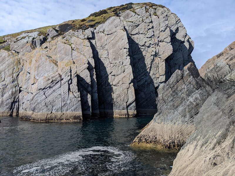
Disregarding the fish briefly, you need to consider your comfort and safety when searching for marks. Particularly when sea fishing. The winter months can make lure fishing from the rocks treacherous and largely unenjoyable.
Fishing a river after a storm tends to create very different conditions for fishing, particularly when targeting predatory fish. The flooded waters stir up food for bait fish and – concurrently – predators, who haven’t been able to feed as normal whilst the storm has raged. Even private venues fish differently after storms, temperature drops or heavy periods of rain.
If there have been heavy storms and you’re planning on fishing a river with a number of tributaries, be wary of flooding.
Narrow it down to a rough location
Now you have an understanding of the type of fishing you’re doing or the type of fish you want to catch, the prevailing weather conditions and how the time of year will affect things, you can narrow things down to a rough location.
Most of us are limited by time, family commitments and transport in one way or another. So you need to define an area that is accessible to you and consider;
- The distance you’re able to travel
- The amount of kit you need to carry
- Your accessibility (both vehicular and on foot)
Look at some catch reports
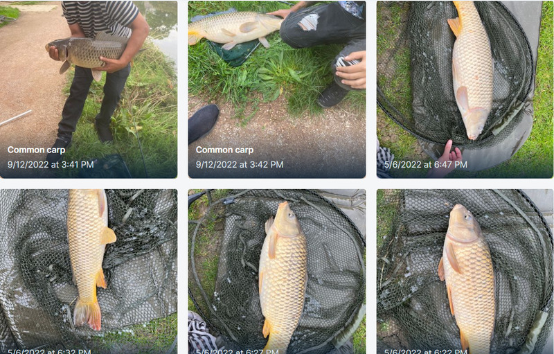
Whilst the majority of anglers are unlikely to give away any specific marks, anglers will upload their catches to certain apps with a rough location attached. Fishbrain is one we use to determine;
- What fish are being caught at a rough mark
- The time of year they’re being caught
- Roughly what the topography looks like
- What gear has had some success there
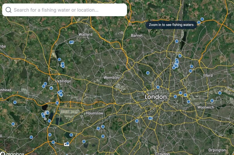
This is typically a first step for us in determining a rough area to start digging into in more detail. There is a free option which is good enough to start with, but as you get more experienced and want to spend more time analysing locations, weather conditions, tackle et al then the premium version gives so much more detail.
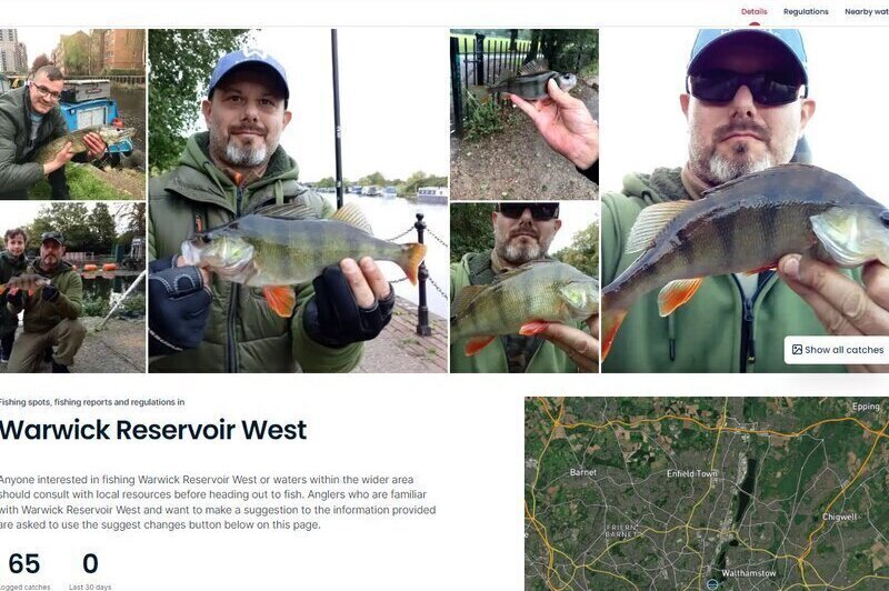
Once you’ve established a rough location or want to dive into a mark in more detail, you can click on one of the blue dots to bring up more information about the location. The overview screen provides logged catches, species, and best fishing time amongst other things on the free version. The premium version unlocks more catch reports, specific spots, tackle, topography, specific catch positions, and artificial reefs amongst other things.
Check out Navionics Chartviewer
Navionics Chartviewer gives you unparalleled and unbridled access to water depths around the world. This is particularly useful when targeting fish like pollock that seek out deeper water and if you’re looking for pickets of deeper water near the shore or deeper bends in estuaries and rivers. Considering it’s free, it’s an absolutely incredible addition to your spot-seeking arsenal.
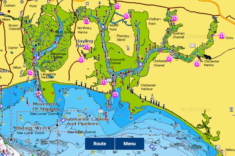
One of our favourite Navionics features is that it has mapped wrecks, shipping lines and other incredibly useful features that help inform your angling, particularly if you have a boat and are looking for some features.
Use Google Maps
This is arguably the most important bit of finding a fishing mark, Particularly if you’re fishing in unchartered territory.
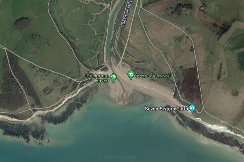
When we’re using Google Maps, using multiple views gives you the best chance of finding a quality, accessible mark. The default map layer gives probably the best overview of areas that may be fishable. Particularly for freshwater locations. But what it doesn’t give you is any real detail about the topography or accessibility of the area.
This is where the satellite view comes in handy. The satellite view provides excellent details you would otherwise miss with the default view including footpaths, roads, water-colour, sediment, gulleys and channels associated with good fishing marks.
Once you can narrow it down to a few options, it’s time to use Google Street View. This view grants you access to real pictures taken by people (or Google) of the environment at each mark. It helps prove or disprove your theories, establish how accessible marks are and how good the area looks for your target species.
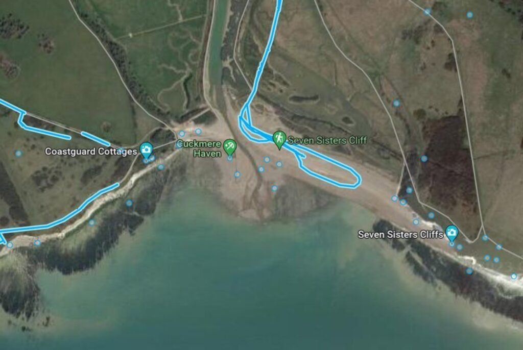
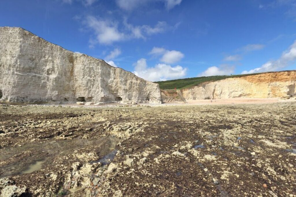
Using Google Street View, you can view uploads taken by members of the public that give you an insight into the specifics of the potential fishing spot. How accessible is it really? What is the ground like? Does it look good for insert species here?
One of the best pieces of advice is to always ensure you have sourced multiple marks. Ultimately what looks like a good mark on Google Maps and Navionics may succumb to unfavourable conditions, so make sure your backup has a backup.
Review forums and expert opinion
Whilst most fishermen are very unlikely to share their favourite marks, lots will share good areas to try in forums, on their own blogs or on YouTube channels. Henry Gilbey has refined the art of sharing enough about an area to give you a good idea of where to start, without giving away too many of the specifics. He’s fantastic for sea fishing with lures around the UK and he has long been a proponent of the Beara Peninsula – arguably our favourite fishing destination in the UK.
For slightly more specific advice, the World Sea Fishing Forum can be constructive and there are plenty of more location-specific forums available like North East Sea Angling and South West Sea Fishing. Ultimately you’ll have to take a bit of a leap of faith at some point, but some local knowledge and expert guidance can go a long way.
How do I know if a fishing mark is good?
Until you go there and try the mark out for yourself multiple times, you don’t really know if the mark is good. Something that looks good on Google Maps and Navionics or that you have read about in forums is unlikely to be an excellent mark all year around. So many external factors are at play that determine whether a mark will fish well – weather, water temperature, currents, the prevalence of food – that until you have fished a mark multiple times you cannot say for sure.
Certain marks tend to have mythical lore (the entirety of Chesil Beach is a good example) but can be really challenging. Whilst you may have heard of Chesil as being a consistently fantastic fishing spot, that isn’t what we have experienced. Fishing marks are rarely as consistent as you’ve heard, so taking everything with a pinch of salt and testing fishing spots a number of times is the only way to really know. But that’s part of the game.
What apps and websites do we use to help us find fishing spots?
The apps and websites that we use to help us find good fishing spots are;
- Google Maps
- Navionics Chartviewer
- Fishbrain
- Tide times
- Met Office Wind Map
- Sea fishing catch reports
All of these can be used for free and provide some superb information about potential marks and how they’ve been fishing recently. Fishbrain is worth a premium upgrade if you’re deciding to take things more seriously, but you absolutely don’t have to.
FAQs
How do I find fishing spots in the ocean?
You find fishing marks in the ocean by;
- Narrowing things down to a rough area
- Using apps like Fishbrain to identify target species location at the right time of year
- Using water depth apps like Navionics to establish likely-looking locations
- Using Google Maps to define accessibility, topography and structure around the mark
- Establishing tide times and wind reports to see weather the spots you have found will fish well at the time of year you need
How do I find coarse fishing marks?
Coarse fishing spots can come in the form of private lakes or rivers, controlled by angling clubs or individuals, or free-to-roam rivers, canals and bodies of water. Private waters are easy to find because they rely on income from individuals like us, so they tend to have websites and appear in Google Maps.
However, if you’re looking for something a little more exotic, then we tend to use a combination of Fishbrain and Google Maps. Narrow down a location, look for catch reports, then use Google Maps’ satellite and Street View to see if you can find some likely-looking marks. Looking for structure and deeper pockets of water tend to be good places to start.


Harry
Hi, I'm Harry. A keen, albeit exceedingly average fisherman. I've spent the last few years trawling London's waterways with - if I'm being kind - varied success and would love to help you avoid the mistakes I have made.

